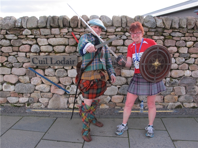
The Culloden Run 17.46k and the Culloden 10K are events organised by the charity Chest Heart & Stroke Scotland in partnership with the National Trust for Scotland. Both runs are based at the NTS Culloden Visitor Centre near Inverness, with the 17.46K run paying homage to the Battle of Culloden in 1746. Both runs recognise the sanctity and historic status of the battlefield and neither run goes on the actual battlefield site or any monuments.
The 17.46K shares the first 8km with the 10K course, following a large triangle of minor roads,, mainly single-track roads with passing places. The first few kms were a wee bit cold with a wind blowing in over the moor from the sea - the Moray Firth - and I was glad I'd worn a t-shirt rather than my running vest. (Later however, I was wishing I had my vest on!). I managed this part of the course easily, only regretting the fact that as I'd been too busy queueing for the loos I'd not had for a last minute swig of water. In fact it was over an hour since I'd had a drink and my mouth was very dry. So, unusually for me, I took a drink from the first drinks station at 5km. There is one long, not-too-steep hill on this part of the course and as the gradient of this is similar to what I have on my routine route back to my house, I managed this 'nae bother'.
Then the longer run turned off from the route shared with the 10K and dropped down to the River Nairn. This section was particularly scenic with lots of old beach, oak and birch trees looking brilliantly colourful. At the 10K drinks station I ate a few jelly sweeties with another wee swig of water. We passed the ancient monument, Clava Cairns, were I was cheered along by visitors commenting that they liked my kilt! In fact, about 20 or so folks commented on my kilt during the course of the run. As an aside, I've dropped a dress-size in the past few months and my kilt is now a bit loose even on the tightest strap setting. With my slippery technical shirt, it kept slipping round so the front opening was almost at the back (you'll see it looking skew-iff in the photos!)
After the ancient monument we had a short, sharp climb up the brae to a road running along above the river. From the heights of this road I could see the long sweep of the Culloden Viaduct ahead. It was quite steep descending to the foot of the viaduct supports and the river and as I was tiring a bit, I went cannily rather than simply 'letting fly'. From about 14km I'd noticed a dull ache in my right quadriceps muscle which I've not experienced before and although it didn't get worse during the run, it was noticeable.
Once across the river came the third and final steep incline and this time I had to resort to walking for 2 x 100m stretches. 
When I got to the top of this slope I'd expected to feel able to sail along to the finish, but in fact I felt really sluggish for the final two kilometres. I didn't have anything in the tank for a final sprint and just about managed to keep up with a lady in pink that I'd been following for the last 8km.
But after all that I was pleased with my finish time of 01:41
You can see the route here (do check the satellite version of the map to see how scenic it is):
connect.garmin.com/activity...
I've shared more of Neil's photos of the day on my Flickr account here:

 )
) 
 for the comment about my legs matching your hair