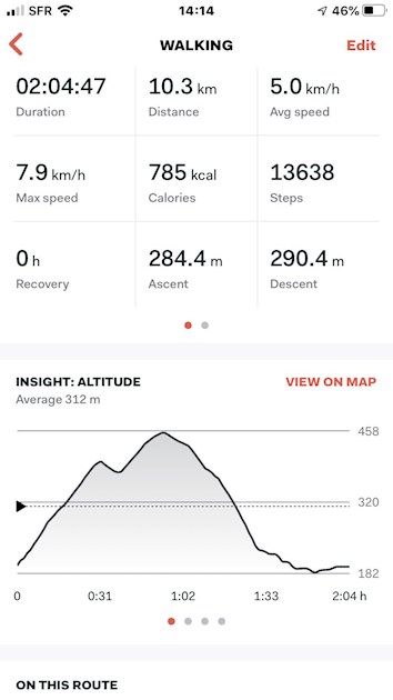
I will admit discovering this route by mistake. After the hard, steep slog to the point at the 31 minute mark, I wrongly assumed the road would drop to my start point. (Note to self: take maps).
The highest point in fact came at the 60 minute marker.
Such incredible views of the Albere hills and in beautiful deciduous trees.
The downhill was a relief even if the last 30 minutes meant watching out for suburban traffic. (Note to self: wear hi viz).
Working on taking the plunge in running shoes now. Next week. Perhaps.