My 1k1h yesterday was 8.12km, 219m elevation, in 56:49. Mildly illegal as my warm-up walk probably put me over the time. Chances of being gendarmed round here are minimal though.
Are you using an app that tells you if you've strayed over the boundary? Any recommendations? I have a pretty good idea of where my boundary is as I've looked at the online maps, but only ESRI recognised where I live, the others refused to locate me accurately! And even ESRI has missing roads...
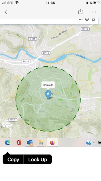
That’s a really good use of time and distance and a very impressive run. A running friend here forwarded me that map and I can work out which roads are which.
This town, Ceret, has 8000 people and quite an active gendarmerie, but there are empty hills so close. In World War 2 it was a main route for smuggling Allied airmen into Spain, away from the eyes of the gendarmes.
Merci beaucoup ! Our hamlet - right next to the forest - was apparently used by the Resistance during WW2; there are rumours of houses being used as ammo stores etc.
I say gendarmes probably wouldn't come up here because frankly they'd be daft to bother, given that the total population of my hamlet and the neighbouring one is 10 adults and three young kids.
That said, I have my attestation with me, just in case!
Content on HealthUnlocked does not replace the relationship between you and doctors or other healthcare professionals nor the advice you receive from them.
Never delay seeking advice or dialling emergency services because of something that you have read on HealthUnlocked.