Need IT genius for (hopefully) the next "Vir... - Bridge to 10K

Bridge to 10K

16,330 members25,994 posts

Need IT genius for (hopefully) the next "Virtual" ultra-relay :)

Irish-John profile image
Irish-JohnGraduate10
89 Replies

A lot of you will remember the COGH run :) The "virtual" relay run from Novo Siberk to Cape of Good Hope was EPIC - and a lot of fun :)For those who weren't here for it - participants were able to enter their milage and the map would update showing "how far" we were along the actual route as if we were running it :) Updates each week included the milage pw, cumulative milage, distance from end and news and interesting trivia from the places we passed through :)

I would dearly like to set up another run. The problem is - Charlies1 who was the genius behind the mapping/website is no longer active in the Forum. Every other part is doable - but a huge element that added to the enjoyment and motivation to run was the "real time" mapping.

If any member can organise this vital part - please let me know :)

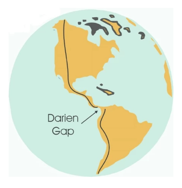
This time, hopefully, we will be running the route shown in the photo. Yes, the Darien Gap does not have a paved route , but we could call that the "off road" section :)

Anyway, let me know if you can help and, pending Admin approval of course, we can set it up :)

Written by
Irish-John profile image
Irish-John
Graduate10
To view profiles and participate in discussions please or .
89 Replies
nowster profile image
nowsterGraduate10

Hmm. Fiddly. Quite a bit of coding needed, I'd have thought.

I have done a bit of coding with OpenStreetMap extracts and plotting lines on them, but it was a long time ago.

nowster profile image
nowsterGraduate10 in reply to nowster

Note to self: this looks promising wiki.openstreetmap.org/wiki...

Irish-John profile image
Irish-JohnGraduate10 in reply to nowster

Anyone who understands that has my unreserved respect! :)

nowster profile image
nowsterGraduate10 in reply to nowster

The hard bits:

* Making the GPX file for the route line.

* Working out the distances along it, preferably at the 1km resolution, for placing a marker.

* A front end for people to add their run distances and a simple database behind it.

The harder bits:

* Support for popping up points of interest on the route.

nowster profile image
nowsterGraduate10 in reply to nowster

Wow! I've broken Google Maps trying to route from Deadhorse, AK to the start of the gap in Panama.

CBDB profile image
CBDBGraduate10 in reply to nowster

🤣🤣 (watching in anticipation)

CBDB profile image
CBDBGraduate10 in reply to CBDB

COGH was great!

CBDB profile image
CBDBGraduate10 in reply to CBDB

Flashback to COGH:

11 Time Zones

16 Countries

25 000 km

… and a lovely wood-medal!

Wooden COGH medal
Irish-John profile image
Irish-JohnGraduate10 in reply to CBDB

It's a brilliant keepsake of an enormously enjoyable participatory C25k event :)

61Lady profile image
61LadyGraduate10 in reply to CBDB

got a t shirt but missed the medal 😏 It looks fab

RunaroundSue profile image
RunaroundSueGraduate10 in reply to 61Lady

I think you could order one now. The people at Sprinters are very helpful and will probably still have the logo.They have just set up a club page for my ukulele group (possibly the only non-running group on their web, although we do have at least 3 runners :) )

Cmoi profile image
CmoiGraduate10 in reply to nowster

I know nothing about coding nowster , but do any of these sites trigger ideas or have features that might make life easier?

racedirectorshq.com/read/ra...

mapcustomizer.com/

nowster profile image
nowsterGraduate10 in reply to Cmoi

All of the above seem to use the low level tools I found above. They don't appear to cope with a route that's going to be about 20,000-25,000km in length.

Just the bit from Albuquerque New Mexico USA to the Darien Gap is over 6700km.

maps.openrouteservice.org/#...

nowster profile image
nowsterGraduate10 in reply to nowster

And even that is too big to download as a GPX or KML file.

Cmoi profile image
CmoiGraduate10 in reply to nowster

Yes, I was rather assuming that anything free wouldn't be able to handle it nowster . It was more so you could evaluate, in a way that I can't, how those sites worked.

It looks like you've already done a huge amount of work looking into possibilities. I really appreciate that.

nowster profile image
nowsterGraduate10 in reply to Cmoi

The display end of things has proved relatively easy, once I got the GPX tracks together.

Irish-John profile image
Irish-JohnGraduate10 in reply to nowster

It is a complex and time consuming project N. Charlie1 really put his heart and soul into it.

nowster profile image
nowsterGraduate10 in reply to Irish-John

What sort of time are we hoping this would kick off? There's a good few evenings and weekends of coding ahead for someone (possibly me). Getting a track on a map is possibly the smallest of the problems.

Irish-John profile image
Irish-JohnGraduate10 in reply to nowster

The Start date would definitely be up to the IT Genius - the beauty of COGH was everyone being able to see on the route how far and where it was run in "real" time :)That also made it very handy to research and give the weekly update on the history, culture, news, photos, trivia etc of the places we would have seen if being on the route in reality :)

Just announcing "so many miles run today" and a vague point on a map doesn't have the same engagement imho, hopefully someone can emulate Charlies1 computer prowess :)

RunaroundSue profile image
RunaroundSueGraduate10 in reply to nowster

My husband has started googling this. Apparently one of the roads in Alaska is only passable in winter, so we should get started soon :)

He also found a road that we "need permission" to use. I said we won't bother about that sort of nonsense, we're a hardy bunch of runners!

nowster profile image
nowsterGraduate10 in reply to RunaroundSue

Also we're virtual, so physical and political limitations don't bother us.

RunaroundSue profile image
RunaroundSueGraduate10 in reply to nowster

Exactly - were we bothered by snakes, crocodiles, hippos or other dangerous animals ? No, we ran right past them :)

CBDB profile image
CBDBGraduate10 in reply to RunaroundSue

🤣🤣🤣

cheekychipmunks profile image
cheekychipmunksGraduate10 in reply to nowster

#didn’tunderstandawordofthat! 😅😅 Kudos for being a whiz, nowster. 🙏🏻

Instructor57 profile image
Instructor57Graduate10

Hope you find your man !(Or have you already 🤔😊)

COGH Was great fun 😁👍

Irish-John profile image
Irish-JohnGraduate10 in reply to Instructor57

Still hoping too I57. Pass the word around :)

Archerygoddess profile image
Archerygoddess60minGraduate

I absolutely loved COGH. I was wearing my t-shirt at the gym last week and one of the instructors asked me about it. It made me think it's about time for another one, but I'd be no use organising it 🙁 You can sign me up for the running, though!

Irish-John profile image
Irish-JohnGraduate10 in reply to Archerygoddess

Thank you Ag :) Put the word out for an IT person - you never know your luck :)

AlMorr profile image
AlMorrAmbassadorGraduate10

I enjoyed walking and running two years ago while doing COGH, that new map looks like the distance from North of Fairbanks in Alaska to Cape Horn at the bottom of South America, coding is quite a complex subject, you would have to do a college course to understand it.

Irish-John profile image
Irish-JohnGraduate10 in reply to AlMorr

I tried educating myself on it, but it's so complex and a formal course would indeed have been vital Al :)

Woollyweaver profile image
WoollyweaverGraduate10

Oo, I do like the sound of that! No help on the virtual side, I'm afraid, but Latin America, and Chile in particular, is my emotional home from home 🥰. Not sure I fancy running down Route 5, the Pan-American Highway though 😱🛻🚐🚗🚚🚛🚙🚗🛻🏍️🛻🚚🚚🚚🚚!!!

Birdlady64 profile image
Birdlady64Graduate10

Hope you find someone to do this. I work in IT but it's way beyond me. COGH was brilliant. Wearing the t-shirt has sparked loads of interesting conversations

Irish-John profile image
Irish-JohnGraduate10 in reply to Birdlady64

I knew Charlie1 was darn good when he designed the COGH map - but only now realising it was more "Genius" than "darn good" 🙂

nowster profile image
nowsterGraduate10

Some background on the Pan American Highway: brilliantmaps.com/pan-ameri...

CBDB profile image
CBDBGraduate10 in reply to nowster

Hang on!? 😳🤨🧐 Wasn’t COGH the longest route in the world? 🤣🤣

Looks great! I’m intrigued to run through the Darian Gap. I lived in Scotland for 10 years, and the Darian Explorations are still a sore point in Scotland’s history!

Irish-John profile image
Irish-JohnGraduate10 in reply to CBDB

COGH is the longest "continous" route in the world C :) PAH falls short because there is no permanent road through the Darisn Gap.

CBDB profile image
CBDBGraduate10 in reply to Irish-John

👍🏽

JoP61 profile image
JoP61Graduate10

COGH was the best fun and made sure I got out to run/walk more than ever before. Good luck with sorting out the IT 🤞

j-runs profile image
j-runs

Ooh this sounds great. I would love to join in the running if you manage to set it up. I’ve just asked my teenage son if it it would be a good project for his A level computer science, as he is casting around for something, and got the usual teenage response – uh-uh-uh – no idea what that means 😊 Best of luck.

Irish-John profile image
Irish-JohnGraduate10 in reply to j-runs

Here's hoping! I bet it would hugely impress the Examiner if he managed it :)

nowster profile image
nowsterGraduate10

I've been using classic-maps.openrouteservi... to generate GPX files.

deadhorse-to-albuquerque.gpx 1.9MB

albuquerque-to-darien.gpx 2.6MB

File: deadhorse-to-albuquerque.gpx

* Length 2D: 6505.120km

* Points: 29554

File: albuquerque-to-darien.gpx

* Length 2D: 6221.167km

* Points: 41461

nowster profile image
nowsterGraduate10 in reply to nowster

turbo-to-buenos-aires.gpx 4.4MB

buenos-aires-to-end-of-road.gpx 772kB

File: turbo-to-buenos-aires.gpx

* Length 2D: 7466.227km

* Points: 70658

File: buenos-aires-to-end-of-road.gpx

* Length 2D: 3111.299km

* Points: 12387

nowster profile image
nowsterGraduate10

My thought is that the Darién Gap is generally thought of as impassable and dangerous, and there's an airstrip at Yaviza (Panama) and one at Turbo (Columbia), so we could take a natural break there, and hop between the two.

Irish-John profile image
Irish-JohnGraduate10 in reply to nowster

Absolutely! I don't think anyone would be such a purist as to say the virtual run could not be done because of such a tiny percentage of the whole :)

Birdlady64 profile image
Birdlady64Graduate10 in reply to Irish-John

😀

Yaviza To Turbo
nowster profile image
nowsterGraduate10

The mapping bit is coming together. And I now have a way of mapping the distances to points on the route.

The North America track.
61Lady profile image
61LadyGraduate10 in reply to nowster

crikey - you’ve done a lot ! Looks very impressive

CBDB profile image
CBDBGraduate10 in reply to 61Lady

I second that! Awesome!

Instructor57 profile image
Instructor57Graduate10 in reply to nowster

Looks like Irish-John has found his man 🤔😁?

Irish-John profile image
Irish-JohnGraduate10 in reply to nowster

That is fantastic news Nowster :) Very encouraging, thank you :)

nowster profile image
nowsterGraduate10 in reply to Irish-John

It'll be less visible progress now as I work on the back end for people to log their runs.

I'm going to implement an open login system, with "set your own password" and no other verification. As long as it's advertised behind a Community Only post, the bots won't find it, and I won't need to do things like using CAPTCHAs or verification emails.

Irish-John profile image
Irish-JohnGraduate10 in reply to nowster

The wee bit of that I understand is great, no doubt in my mind the rest is also :) You're a Star! 🙂

nowster profile image
nowsterGraduate10 in reply to Irish-John

The back end is started. The distance database is in. I can now feed in a number and it will move the pointer to that place on the trail. I've also tried out the OpenTopo map which shows relief detail.

Screenshot.
Leotigris profile image
LeotigrisGraduate10 in reply to nowster

that looks brilliant!

CBDB profile image
CBDBGraduate10 in reply to nowster

🤩🤩🤩

HeavyFoot profile image
HeavyFootGraduate10

Ooch - don’t mention the Darien Gap on St Andrew’s Day.

nowster profile image
nowsterGraduate10 in reply to HeavyFoot

Yes. That was a bit costly for Scotland, wasn't it?

HeavyFoot profile image
HeavyFootGraduate10 in reply to nowster

The Act of Union probably wouldn’t have happened otherwise. But let’s move on - unwise to run on quicksand!

nowster profile image
nowsterGraduate10

Both continents

Track through North and South America
nowster profile image
nowsterGraduate10 in reply to nowster

And zooming in to the gap:

The Darien Gap
Cantstopmenow profile image
CantstopmenowGraduate10

A fabulous idea. I really enjoyed COGH and reading the contributions from so so many on this forum. I still wear my T shirt! It seems like nowster is up for a huge challenge. 🤞🤞 Wishing you luck

Leotigris profile image
LeotigrisGraduate10

I've never heard of the COGH run before. Could this be resurrected and rerun perhaps? (in addition to the new north and south america one)

Irish-John profile image
Irish-JohnGraduate10 in reply to Leotigris

COGH was an amazing event Leo. Runners logged their individual miles which moved the pointer along, we had virtually pin point precision of where we would be as the cumulative miles built up, and every Friday a "travelogue" covering what was along that weeks section :)It was one of the most fun forum events, but I don't think we could run it again as the original IT organiser seems to have gone dark. And, tbph, it was fun because it was a new challenge as well as a "new route" so I don't think we'd have the same enthusiasm for repeating it. But - who knows? :)

nowster profile image
nowsterGraduate10

That article said the route is 40,000km, but it isn't! It's actually about 23,000km. (23303km on the route I computed, skipping the Darien Gap.)

Edit: Wikipedia says 30,000km, which might be the variant which goes via Winnipeg and Minnesota.

Irish-John profile image
Irish-JohnGraduate10 in reply to nowster

I think the most direct route would be best? 🙂

nowster profile image
nowsterGraduate10

There are three potential routes through North America:

- Whitehorse - Edmonton - Thunder Bay - Minneapolis - Kansas City - San Antonio - Monterrey - Mexico City (longest)

- Whitehorse - Edmonton - Calgary - Denver - El Paso - San Antonio - Monterrey - Mexico City

- Whitehorse - Edmonton - Calgary - Butte - Las Vegas - Los Angeles - San Diego - Nogales - Mazatlan - Mexico City

- Whitehorse - Vancouver - Sacramento - Los Angeles - San Diego - Nogales - Mazatlan - Mexico City

None are "official". I've gone for the second one. Do you have any preferences?

upload.wikimedia.org/wikipe...

Irish-John profile image
Irish-JohnGraduate10 in reply to nowster

Second one looks fine 🙂👍🏻

CBDB profile image
CBDBGraduate10 in reply to Irish-John

bummer. I love Vancouver! But no worries! But just had to say: Vancouver is awesome! (Met a bear there and didn’t run away)

nowster profile image
nowsterGraduate10

Incidentally, Charles1 has reached out with an offer of help (and to reuse the COGH stuff). I'm enjoying this challenge too much (and have got so far already) that I don't really want to abandon it now.

What I will need is help with the prettification. I tend to do stuff that's quite minimalist and functional. I also tend to go for simpler colour schemes as I have deuteranomolous vision (shifted green colour blindness).

For example, this is the control page for my central heating system (yes, I wrote my own rather than getting something like Hive). The buttons on the lower half change the settings and they turn yellow when active. "Advance" means "do this until next programmed event". "Force" means "just do this".

A screenshot of a website for controlling my central heating system.
Irish-John profile image
Irish-JohnGraduate10 in reply to nowster

Sounds good to me N :)

RunaroundSue profile image
RunaroundSueGraduate10

I'll be up for this IJ. It looks as though nowster is making amazingly good progress.

I just mentioned it to my husband - his comment when I said Darien gap was "well that usually ends well" . It always amused him that COGH was taking in so many dangerous countries :)

Irish-John profile image
Irish-JohnGraduate10 in reply to RunaroundSue

A bit of danger is the spice of life ;)

RunaroundSue profile image
RunaroundSueGraduate10

Oh yes, meant to say that I will be happy to contribute some culinary research and updates as we run along. They seemed popular on the COGH expedition

CBDB profile image
CBDBGraduate10 in reply to RunaroundSue

definitely

Irish-John profile image
Irish-JohnGraduate10 in reply to RunaroundSue

Your Culinary posts were brilliant RAS! :) Please do on this run 🙂👍🏻

61Lady profile image
61LadyGraduate10 in reply to RunaroundSue

loved your COGH input - d’you know, I think this might really happen 😀 nowster seems to be going great guns with another winning idea from Irish-John 👍

Week7 profile image
Week7Graduate10

I'm getting excited now.! I really enjoyed COGH!! When I first read your post I thought it was a brilliant idea but looked like the IT was going to be an issue. Now it looks like THE nowster has stepped in to help it become a reality ! I have everything crossed that this will happen.

As a complete IT numpty all I can offer is my thanks for your idea and the hard work of all who can make it a reality .

Irish-John profile image
Irish-JohnGraduate10 in reply to Week7

Nowster is making this possible:) 👍🏻

CBDB profile image
CBDBGraduate10 in reply to Irish-John

woohoo!! 🙏🙏🙏🙏👏👏👏👏😀

Frizzbomb67 profile image
Frizzbomb67Graduate10

I loved the COGH (still wear my t shirt with pride 😊) and am up for the next challenge! Minimal IT skills I’m afraid but Nowster looks like he’s your man 👏🏻👏🏻

Curlygurly2 profile image
Curlygurly2Graduate10

I can't help with the IT stuff, but I enjoyed the last one, so please keep me posted xx

Irish-John profile image
Irish-JohnGraduate10 in reply to Curlygurly2

Absolutely CG :)

CBDB profile image
CBDBGraduate10

I’m still thinking of an acronym. (We can’t keep calling it COGH2, now can we?)

How about NASAR (North America - South America Relay)?

Or do you already have an acronym up your sleeve? 🤩🤩🤩

Irish-John nowster

Leotigris profile image
LeotigrisGraduate10 in reply to CBDB

NASAR sounds good

CBDB profile image
CBDBGraduate10 in reply to Leotigris

👍🏽

Somehow I completely missed the COGH (no idea how) but it sounds like great fun. I would definitely like to contribute to the next race!

Irish-John profile image
Irish-JohnGraduate10 in reply to

Excellent! :)

It was indeed great fun, HW :) Hopefully this one will be just as much, and as motivating to go out the door :) We had a lot of contributors - people basically posted any memories, news, odds and ends etc as we 'ran' through the route :) Russia took FOREVER lol. A lot of people remarked how it really gave the sheer physical size of it in a context they hadn't thought of before :) There were lots of interesting gems along the way regarding local people and culture - it really was fun :)

Irish-John profile image
Irish-JohnGraduate10

Teeny tiny update :)

I'm in touch with a couple of gung-ho Aussies who made the trip through the Darien Gap a few years ago :) They did a brilliant write-up about it so there will be more coverage of that 'Rest Section' part of the route than I thought at first would be possible - in other words, will now be able to 'fill in the gap of The Gap" lol. And, when you read it you will see why there is no way in heck you would want to travel through it :) 150kms of sheer real estate insanity lol

CBDB profile image
CBDBGraduate10 in reply to Irish-John

🤩🤩🤩

You may also like...

Cape of Good Hope Relay - We have reached the Road of Bones

better known....

10K target? HM hopes? May's virtual HealthUnlocked HM and 10k events are made for you! 📢🏅🏃‍♀️

take part at any other time Sunday 14th - Sunday 21st May inclusive. You get to choose your route...

This is Mapping Anonymous! How much time do you spend on mapping the perfect 5k route?

extensively to map my routes. I know what they look like via OS maps, Satellite and open-source...

February Quest - Final few days

pace • To try out some new running routes It's completely up to you - set yourself an achievable...

(not)parkrun / Virtual 5K

in buggies. You can walk, jog, run, run/walk, it's not a race, just a run in the park and loads of...