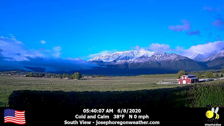
These are photos from the weather cameras for our area. (My house is at the very far left in the distance on the other side of the big meadow.) The mountain I drew is actually to the left of this photo.
The mountain in the middle of the "south view" (with the 4 vertical stripes, which are avalanche chutes) is Chief Joseph Mountain, and it is about 9600' high. For comparison, the house is at 4150'. And the snow line is about 6200'.
We didn't get frost in town (for which my garden plants are happy) but it did get down to 38 degree F which is about 3 degrees C for those of you elsewhere.
The ability to reply to this post has been turned off.
Chief Joseph, leader of one of the Nez Perce bands. It's good that things are named after these good people in tribute. The fact that a great many natives ended up in reservations is nothing but criminal. The mountain stands tall and proud, like its namesake. Thanks for sharing.
Yes, I have read a little about it and will read more later. The way they were all treated makes me so angry. On another matter, do you know what happened about Standing Rock, the last I heard anything was when Trump got in and gave the go ahead for the laying of the pipes.
Washington, D.C. — March 23 A federal court -- granted a request by the Standing Rock Sioux Tribe to strike down federal permits for the controversial Dakota Access Pipeline.
Content on HealthUnlocked does not replace the relationship between you and doctors or other healthcare professionals nor the advice you receive from them.
Never delay seeking advice or dialling emergency services because of something that you have read on HealthUnlocked.