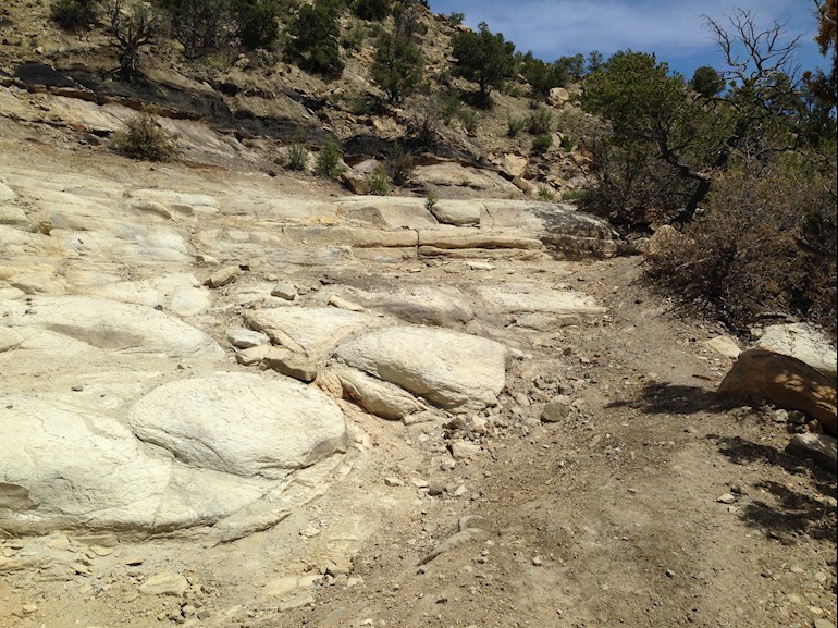
After walking 800+ feet up to the summit in 3.4 miles, I started recording on Strava and jogged back down this ridiculously technical eroded out road. Descending from 7400 feet to about 6600 feet.
It's 82° F right now. I didn't intend on doing this. I merely wanted to find this road. Once I did though, it was all over. I was going to the top. No water for two hours of this. I easily burned 1300 calories on this one.
It's an eye foot coordination technical training ground for sure. In some places, all I do is a prance type thing if I want to keep moving and not walk. I will progress to going up this section and down a better road. This was an impromptu scouting trip.
You are nuts! A man after my own heart! Where I am at the moment is built on limestone, what isn't paved looks a bit like your pic, although the rocks are smaller. Do take care though, make sure someone knows where you are, and carry your phone won't you?
Thank you, I do carry a phone. Find my iPhone is on. Soon, I'll be using Premium Strava so anyone I choose can see me moving about live. I also carry bear spray in case a cougar or bear gets interested in me. We are in bear and cougar country. Although right now, the bears prefer town since it's easy pickings for them.
Content on HealthUnlocked does not replace the relationship between you and doctors or other healthcare professionals nor the advice you receive from them.
Never delay seeking advice or dialling emergency services because of something that you have read on HealthUnlocked.